Masters degree in Oceanography

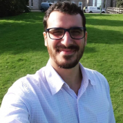
Joao Lucas Eberl Simon
Bio
Joao Lucas Eberl Simon is a Brazilian researcher focused on marine sciences and climate change. He graduated in oceanography on the Federal University of Rio Grande (Brazil), with his research topic focusing on monitoring the Antarctic Circumpolar Current (ACC) using satellite altimetry data. He has worked in projects such as MOVAR (volume and heat transport in the Brazilian Current), INCT-MC (Climate changing) and SIMCosta (costal monitoring with multi-parametric buoys), including two 9 days long cruises. His Master of sciences degree was granted by the Federal University of Santa Catarina (Brazil), where he studied the relation of the ACC’s latitudinal oscillations with wind and El Niño/La Niña using remote sensing. His current research investigates the applicability of lightweight drones for sensor deployment, water sampling and remote sensing. He is a Ph.D. student at the University of Exeter (UK) and part of the Aquasense’s early-stage researchers team, which is a project funded by the European Union’s Horizon 2020 research and innovation programme under the Marie Skłodowska-Curie grant agreement.
Qualification
Project
RP12: UAVs or aerial drones for autonomous sensor deployment and spatial water quality observations (ESR12, EXT)
The need to deploy sensors in environments unsuitable or inaccessible to humans, such as hot springs or contaminated lakes, requires a remote deployment method where the user is not exposed to the conditions experienced by the sensor. To overcome these challenges, ESR 12 will developed strategies similar to RP11, but this time with UAVs. The goal is to explore the potential of lightweight drones for deploying small automated sensor technologies and collecting water samples (for later laboratory analysis) in environments unsuitable or inaccessible to humans. ESR12 will also explore the range of possibilities and accuracy of remote sensing water quality parameters from lightweight drones. Water quality parameters, including total suspended matter and turbidity, can be observed using optical remote sensing. Therefore, a drone carrying an optically characterised and fully controlled digital camera will be used to map the spatial variations in these water quality parameters. Further, the use of drones to deploy light-weight sensorized buoys developed in RP9 will be explored for the first time. In the first instance, the buoys will be simply dropped in water. This will be followed by complex task such as picking buoys from one place and dropping it at other desired location.

